A Guide to Backpacking Death Hollow in Escalante, Utah

I decided to write this quick post to aid future travelers to the gorgeous Death Hollow trail near Boulder, Utah. Though we attempted to follow the Google Maps directions from the AllTrails app, we were led astray and had to backtrack to the Anasazi State Park center in Boulder to buy topographical maps for more specific direction. Beyond that, the trail itself was confusing and we did not know what the camping situation would look like when we got there. Here are some pointers that would have helped us a lot to have in advance.
Getting there from Salt Lake City.
Here is a custom map on Google to the Boulder Mail Trail beginning from Salt Lake City.
There is a makeshift airstrip near the trailhead that a little hard to find on conventional maps or when you’re out of cell service range like we were. Here’s trail map that my dad drew over one of the topographical maps we bought:

You cross Sand Creek to get to Death Hollow Canyon.
Sand Creek offers the first opportunity to access water on the trail. It’s about two miles in. But do not be confused: This is not Death Hollow canyon. From the trail descriptions we read, it appeared that you merely descend from the parking area at the trailhead into a canyon and then follow the water. This is not the case. You cross the stream in Sand Creek, and then the trail veers away from the water and you hike out onto a plateau between the two canyons.)
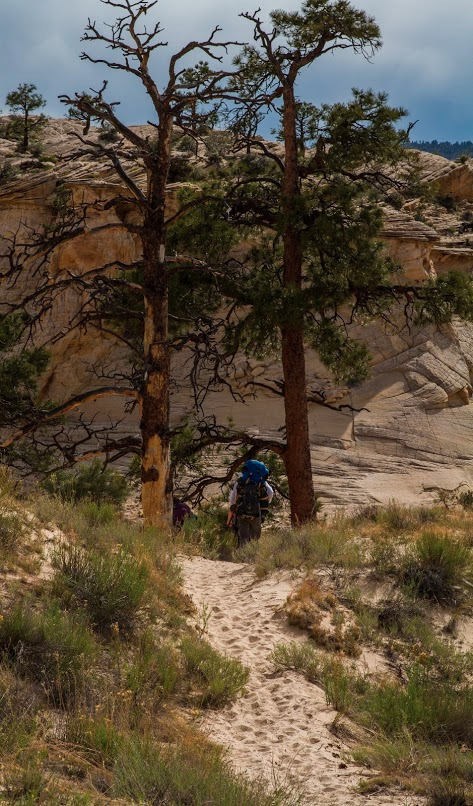
Hiking away from Sand Creek. The trail gets dry and dusty.
It’s approximately 6 miles from the trailhead to the overlook of Death Hollow — one of the most gorgeous views of the trek.
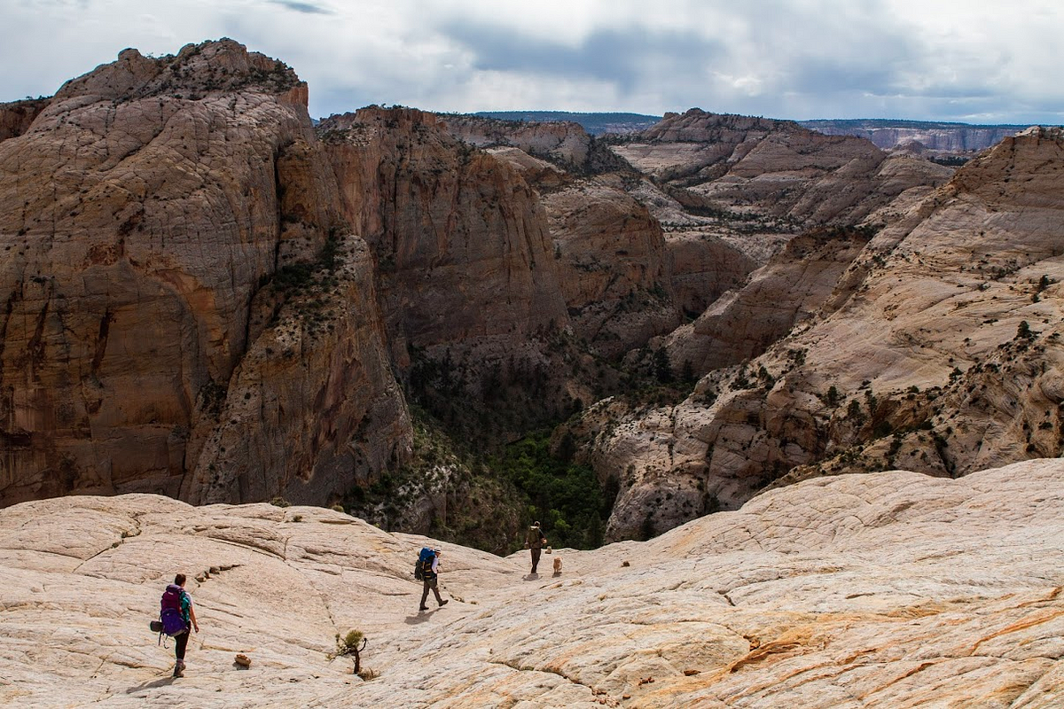
It’s confusing if you try to find Death Hollow on Google Maps, because though you can see the topography of the canyon, it doesn’t appear to have any water running through it, unlike Sand Creek. Death Hollow canyon has plentiful water, ranging from shallow areas to deep pools.
Go early to get a good spot.
Especially on holiday weekends like Memorial Day (when we went), the first good patches of sand next to the river fill up quickly with backpackers (it only takes a few because there aren’t many spaces). My advice would be to go as early as possible in the weekend to nab a good piece of of real estate. We ended up having to hike an additional mile, already weary, to find a suitable location (and ours was kind of mediocre as it was in the center of the trail).
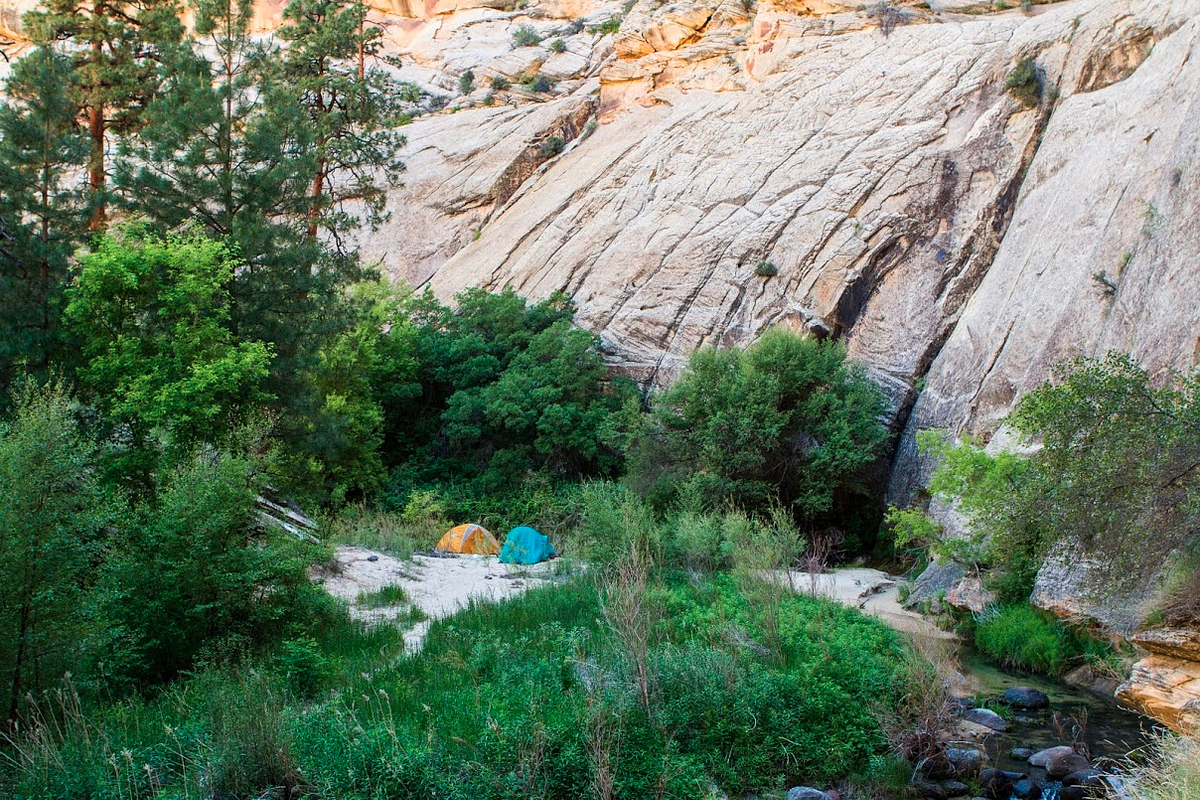
First night’s site in the middle of the trail.
Dogs are allowed, but be aware of the water situation.
Our golden retriever, Ricotta, is 8 years old. She’s sturdy, but she has a heavy fur coat, so this late spring hike was pretty warm for her. We constantly had to take breaks to avoid overheating her. I would not advise bringing your dog between June and September. For the first 6–7 miles of the trail, water is sparse, excepting the Sand Creek stream — but the trail doesn’t keep you next to it for more than a quarter of a mile.

Beware the poison ivy!
We did not realize before we went that the areas surrounding the stream in Death Hollow Canyon are covered with poison ivy— which looks like this:

If you get the oils from the leaves on your skin, they can cause very itchy and unpleasant rashes.
One solution is to wear long, breathable hiking pants and a long-sleeved shirt. However, the oils from the poison ivy leaves can linger on your clothing if you brush against it, so be aware of touching your skin after touching the exterior of your clothes. I would also bring a change of clothes to wear while in camp.
Another, solution is to bring water-wading shoes and to walk in the river, which is often what we did.
I hope that taking these tips into account will let future backpackers and hikers enjoy the trail and its awe-inspiring natural beauty more fully.
Many thanks to Fiona Foster for taking the photos!