Climbing Mt. Shasta
Video
Podcast version on Spotify
Our summit bid was in doubt until the moment we set foot on it. Leading up to and after our climb, foreboding cumulonimbus clouds sailed around Shasta, strafing the surrounding landscape with lightning. I also almost lost the mental battle against pain from my blisters and fatigue.
We arrived in the evening on Friday to Northgate trailhead. The drive-in was particularly sporty because Google routed us along an unfrequented fire road that seemed like it was gradually being reclaimed by vegetation. Bushes put some good scrapes in the side of the truck.
My climbing partner, Nick, was waiting for us in his Subaru. He and I met at a wedding about a month ago in Santa Barbara. We were seated at the same table at the reception and hit it off after he mentioned he had climbed Denali. “That’s my objective!” I exclaimed through a mouthful of wine. After some conversation, it felt a lot like Nick was a version of myself three years into the future, having worked his way from guided trips on Shasta during the pandemic to technical climbs in the Alaska Range. We made plans to try Shasta together shortly thereafter.
After greetings, we made carne asada burritos and sipped beers in the parking lot while the temperature dropped and the light faded, casting a glorious pinkish glow over the summit. In the windows between cloud cover, we snatched binocular-assisted glimpses of our route to check the conditions. Even with our magnified vision, we couldn’t really tell how the snow looked. We brought our ski touring setups, but riding through giant sun cups is no fun. We ultimately decided to risk it and pack the skis.
Looking back on it now, I regret ever suggesting that we try a ski descent of Shasta. By this last weekend of June, the snow line had receded far above the trailhead. The first continuous snow turned out to be 3 miles in and a thousand or so feet higher than our starting point. Carrying ski equipment on top of my mountaineering loadout made my pack weigh something on the order of 60 or 70 pounds. It added a lot of pain for very little upside.
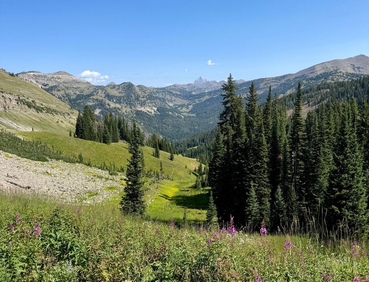
Day one started with a pleasant trek through the trees, though we were heavily loaded and sweating profusely, our skis catching overhanging branches as we moved. Some two miles in, I started to notice hotspots on my heels. A combination of overly-thick socks, lots of weight, and newish mountaineering boots. I applied moleskin to my sweaty feet, but it got rubbed off its placement as we continued. My blister situation felt amateurish and kind of embarrassing being in Nick’s company. I wanted to show that I had at least a little experience during our first climb together. I suppressed the pain and trudged on, vowing to fix my feet at camp. In the back of my mind, I reflected on the ropemate I had on Rainier who turned back on summit day because of the same kind of heel blistering.
We found the first worthy snow somewhere around 8000 feet and switched to our touring setups. It was such a relief to have the skis on the ground, instead of catching on trees and burdening my back. At last, I thought, the fun part begins.
We toured about 700 vertical feet higher, turning the corner left into the expanse below high camp. Things looked encouraging for a moment with snow stretching off into the distance. But it didn’t last; we got to the scrubby brush and found only rocks. We both agreed that trekking more with the skis loaded on our packs just sucked. We ditched the ski gear under a bush and continued on foot.
When we got to camp, a guided crew from Shasta Mountain Guides had taken the tent platforms Nick had intended for us. But they directed us up the slope and mentioned there was running water—a stream of melt-off snaking through the boulders.
Nick and I continued up the hill and deployed our tents in small, flat areas other climbers had hewn from the rocky terrain. We strained the water from a stream into our receptacles through my buff to filter out the sediment. Nick commented that there was an oily-looking substance on the surface of his Nalgene water, and I later realized it was some greasy mixture of sunscreen and sweat from the buff I was wearing. Oh well.
We settled in for the evening at our perch on the boulder field below the moraine next to Hotlum Glacier, cooking food, napping, and watching the weather. I managed to rig up a kind of gauze cast around my ankle in an attempt to pin the moleskin over my increasingly raw heels.
Somehow we had 5G cell service. “The forecast updated. Now there’s thunderstorm risk at 10:00am tomorrow,” Nick said from his tent. That messed up our plans for a 3:00am start. We were estimating that it would be about seven hours to the summit from here and then two back down. We knew for certain we didn’t want to be caught on the summit or some high ridge and zapped to smithereens. Neither Nick nor I even wanted to be at camp underneath one of these anvil clouds. We were pretty far above the tree line and felt like fleshy lightning rods. We decided to split up and talk to our neighbors to see what their plans were.
The guides told me that they were hunkered down, waiting to see what would happen. They were still planning a go-time around 3:00am. When I told Nick, he said “Well, they’re probably not going to summit.” It was far too late of a start to beat the weather risk. We decided to set our alarms for midnight and attempted to sleep around 7:00pm.
I woke to bright flashes in my tent around 11:00pm. Panicked, I ripped open the zippers and peered outside. Foggy clouds billowed around the tents. “Oh shit,” I thought, “it’s right on top of us.”
“Nick! Lightning.”
Another flash. It looked far away. We pulled out our phones again and tried to find out what the weather was doing. Nick pulled up a site with a radar projection, which showed that the system producing the lightning was 50 or so miles to the north, but damn did it feel closer in the dark. The radar predicted it would blow north and dissipate. This ended up being the case, but we were jittery.
I dozed for what felt like another minute before my phone alarm went off. We roused and made coffee and oatmeal in the red light of our headlamps. I wasn’t sure exactly why we were using the red light, but Nick was doing it, so I followed suit. It made everything feel a bit like a horror movie.
Nick and I threw on our packs and started up the slope by about 12:30am, stopping at the snow line to put on 12-point crampons. Then, we trudged. Hours in the dark went by. We both retreated into our thoughts, only speaking to point out hazards or clarify the route. Nick followed Gaia GPS on his phone because we couldn’t see anything beyond 100 feet away. Our line became very steep. The best I could tell, the slope angle tipped up to and possibly over 40 degrees. Footing lost here would probably have fatal consequences. I brought out my axe and began stabbing my way up the small switchbacks Nick made.
Around 4:00am, we crossed from a snowfield over a rocky ridge and onto “the ramp” of the Hotlum-Bolam route around 12,600 ft. A little higher than we intended, but we were determined to be nowhere near the crevasses of the Hotlum glacier, which guards the bottom of the ramp. In the dark, I scraped my crampons over rocks. It felt precarious.
From here, the ramp took us straight up to a pyramid-shaped snowfield below the summit block. I took the lead, feeling okay at altitude. After a few switchbacks, I found the bootpack from other climbers, which went straight up to the Rabbit Ears rock towers. Nick didn’t like the look of the near-vertical path the bootpack took in front of us so we cut right and ascended to the south summit.
After a short traverse across the summit ridge, we dropped our packs and stood on Shasta’s highest point. It was about 6:30am.
My feet were in bad shape. I tore off my complicated, yet failing, gauze bandages and opted for simple bandaids. I knew they wouldn’t hold for long, but I needed something to get me back down to camp.
We descended after about 20 minutes on the summit. Nick raced down in front of me. We were about equal on the climb, but he was significantly faster on the descent. I felt at points like I was jogging down the ramp in crampons.
4,000 vertical feet later, we arrived back at our camp and gathered up our things. I was so fatigued that the re-packing which should’ve taken me 15 minutes, took more like 45. My legs cramped up each time I crouched to pick something up off the ground. The guides who we consulted the night before had indeed not summited with their clients, but they congratulated us as we passed them.
We got back down to 8,700 feet where we stashed our touring gear, but it took us some 15-20 minutes to find it again. I sighted Nick’s splitboard poking up from the bushes, and I wrenched my destroyed feet out of my Nepals and into the touring boots. No good.
My attempt to ski Shasta lasted about 10 minutes. I slid down the rotten snow and dropped both mountaineering boots along the way, not having been bothered to secure them correctly on my pack.
When I ran out of snow, I stowed the skis on my backpack once more and jammed my raw feet back into the sweaty Nepals. Shouldering the 60-ish-pound pack, I drew on all of my reserves to stomp back down to the car. I knew the forest down to the Northgate Trailhead was gorgeous, but I couldn’t appreciate it through the pain and fatigue. I became angry at the trail and its makers for creating such a rambling, non-direct route back to the cars. We walked for what felt like miles of winding path, losing only a few hundred feet of vert at a time.
When we got back to the cars (which I once more forgot to take video of) I unceremoniously dropped my pack in the back of Nick’s Subaru and hobbled to the passenger’s seat. We’d completed Shasta. From the standpoint of the physical toll it took on my body and the amount of willpower I had to summon for the finish, Shasta’s Hotlum-Bolam route was the hardest climb I think I’ve done to this point.